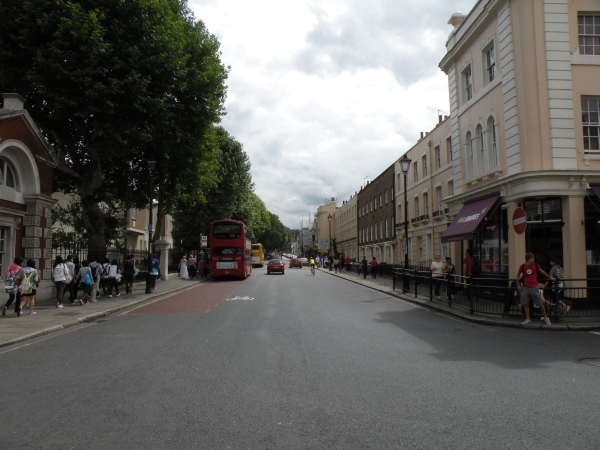
King William Walk
 OVERVIEW
 IMAGES
 MAP
MAP BUSINESS MAP
 RETAIL MAP DIAGRAM
King William Walk is located in Greenwich Town Centre. It leads up to Greenwich Park at the south end and Greenwich Pier at the north end.
Adjacent Streets include College Approach, Old Royal Naval College, Turnpin Lane, Nelson Road, Romney Road and Nevada Street.
There are 8 businesses on King William Walk.
Number of businesses on this street: 8
Nearby Streets and Stations
- Nearby Streets:
- Nelson Arcade (0.03 miles)
- Nelson Road (0.03 miles)
- Turnpin Lane (0.03 miles)
- Greenwich Market (0.05 miles)
- Durnford Street (0.06 miles)
- Romney Road (0.07 miles)
- Greenwich Church Street (0.08 miles)
- College Approach (0.08 miles)
- Old Royal Naval College (0.1 miles)
- Creek Road (0.11 miles)
- Nevada Street (0.11 miles)
- Stockwell Street (0.11 miles)
- Crescent Arcade (0.12 miles)
- Crooms Hill (0.15 miles)
- Greenwich Promenade (0.16 miles)
- Burney Street (0.17 miles)
- Haddo Street (0.26 miles)
- Park Row (0.26 miles)
- Royal Hill (0.26 miles)
- Wood Wharf (0.27 miles)
- Crane Street (0.3 miles)
- Circus Street (0.31 miles)
- Greenwich High Road (0.33 miles)
- Victoria Parade (0.33 miles)
- New Capital Quay (0.34 miles)
- Park Vista (0.35 miles)
- Nearby Stations:
- Cutty Sark - DLR (0.13 miles)
- Greenwich - Overground (0.31 miles)
- Greenwich - DLR (0.39 miles)
- Maze Hill - Overground (0.48 miles)
Shops on King William Walk
- Business types on this street:
- Restaurants (2),
- Pubs and Bars (2),
- Convenience Stores (1),
- Parks and Gardens (1),
- Bakers (1),
- Estate Agents (1).
- Number of businesses on this street:
- 8

