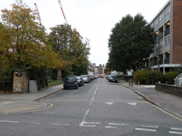
Burney Street
 OVERVIEW
 IMAGES
 MAP
MAP BUSINESS MAP
 RETAIL MAP DIAGRAM
Burney Street is a mainly residential street located in Greenwich Town Centre that runs parallel to Greenwich High Road.
It is situated between Royal Hill at one end and a three way junction with Nevada Street,Stockwell Street and Crooms Hill at the other.
There are currently no businesses open on Burney Street
Number of businesses on this street: 0
Nearby Streets and Stations
- Nearby Streets:
- Crooms Hill (0.07 miles)
- Stockwell Street (0.07 miles)
- Royal Hill (0.09 miles)
- Nevada Street (0.1 miles)
- Circus Street (0.14 miles)
- Nelson Road (0.15 miles)
- Nelson Arcade (0.16 miles)
- King William Walk (0.17 miles)
- Turnpin Lane (0.18 miles)
- Greenwich Church Street (0.18 miles)
- Durnford Street (0.18 miles)
- Greenwich High Road (0.18 miles)
- Greenwich Market (0.19 miles)
- Creek Road (0.19 miles)
- Brand Street (0.21 miles)
- Crescent Arcade (0.21 miles)
- College Approach (0.21 miles)
- Romney Road (0.22 miles)
- Haddo Street (0.24 miles)
- Tarves Way (0.27 miles)
- Waller Way (0.27 miles)
- Old Royal Naval College (0.27 miles)
- Greenwich South Street (0.29 miles)
- Greenwich Promenade (0.31 miles)
- Lovibond Lane (0.31 miles)
- Norman Road (0.34 miles)
- Nearby Stations:
- Greenwich - Overground (0.18 miles)
- Cutty Sark - DLR (0.21 miles)
- Greenwich - DLR (0.28 miles)
- Maze Hill - Overground (0.59 miles)

