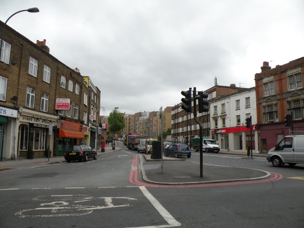
Blackheath Hill
 OVERVIEW
 IMAGES
 MAP
MAP BUSINESS MAP
 RETAIL MAP DIAGRAM
Blackheath Hill is located on the edges of Ashburnham Triangle and heads up towards Shooters Hill Road and Blackheath.
It has a junction with Greenwich South Street, Blackheath Road and Lewisham Road. Other adjacent streets include Plumbridge Street.
The nearest station is Deptford Bridge on the Docklands Light Railway.
There are 7 businesses on Blackheath Hill.
Number of businesses on this street: 7
Nearby Streets and Stations
- Nearby Streets:
- Plumbridge Street (0.03 miles)
- Guildford Grove (0.1 miles)
- Blackheath Road (0.16 miles)
- Greenwich South Street (0.18 miles)
- Ashburnham Grove (0.18 miles)
- Catherine Grove (0.21 miles)
- Brand Street (0.26 miles)
- Waller Way (0.31 miles)
- Lovibond Lane (0.31 miles)
- Circus Street (0.32 miles)
- Greenwich High Road (0.33 miles)
- Royal Hill (0.38 miles)
- Tarves Way (0.4 miles)
- Norman Road (0.46 miles)
- Burney Street (0.47 miles)
- Crooms Hill (0.52 miles)
- Stockwell Street (0.53 miles)
- Haddo Street (0.53 miles)
- Nevada Street (0.56 miles)
- Greenwich Church Street (0.61 miles)
- Nelson Road (0.61 miles)
- Creek Road (0.61 miles)
- Nelson Arcade (0.62 miles)
- Durnford Street (0.62 miles)
- Crescent Arcade (0.63 miles)
- Turnpin Lane (0.63 miles)
- Nearby Stations:
- Deptford Bridge - DLR (0.34 miles)
- Greenwich - DLR (0.34 miles)
- Greenwich - Overground (0.36 miles)
- Cutty Sark - DLR (0.62 miles)
Shops on Blackheath Hill
- Business types on this street:
- Fast Food Take Away (1),
- Bakers (1),
- Pharmacies (1),
- Sign Shops (1),
- Restaurants (1),
- Pubs and Bars (1),
- Hairdressers - Womens (1).
- Number of businesses on this street:
- 7

